Broxbourne is a town in the Borough of Broxbourne in Hertfordshire, England, with a population of 15,303 at the 2011 Census. It is located to the south of Hoddesdon and to the north of Cheshunt, 17 miles (27 km) north of London. The town is near the River Lea, which forms the boundary with Essex, and 5 miles (8.0 km) north of the M25 motorway. To the west of the town are Broxbourne Woods, a national nature reserve. The Prime Meridian (0 degree) runs just east of Broxbourne.
The name "Broxbourne" is believed to derive from the Old English words brocc and burna meaning "Badger stream", indeed within the Broxbourne woods there are often seen wild badgers, together with deer, squirrels and other woodland creatures. The Manor of Broxbourne has an entry in the Domesday Book as Brochtsborne, where Broxbourne Mill is listed. The manor was held in the time of Edward the Confessor by Stigand, the Archbishop of Canterbury, but had passed into Norman hands following the Conquest. King John granted the manor to the Knights Hospitallers until the Dissolution, when it passed to John Cock, after whose family Cock Lane is named. Broxbourne grew around inns on the Great Cambridge Road, now known as the A10. A number of old houses and inns dating from the 16th to the 19th centuries still line the High Street (now the A1170).


The parish church of St Augustine was entirely rebuilt in the 15th century, although a 12th-century Purbeck marble font survives. The interior has a number of monuments and brasses dating from the 15th to the 19th centuries. The three stage tower has a belfry with a peal of eight bells, three of which are dated 1615
A terracotta works was opened in the 1840's by James Pulham and Son, who specialised in creating artificial rock garden features; some of their work survives in the gardens at Sandringham House in Norfolk and Buckingham Palace.
Pulham House was demolished in 1957. All that remained was one of the six brick kilns and the horse-drawn puddling wheel that ground the terracotta, which are now Grade II listed. The local council originally conserved these in 1986, and in 2016 full conservation was undertaken as part of a joint project between B3Living, Lowewood Museum and Broxbourne Borough Council, with support from the Heritage Lottery Fund.
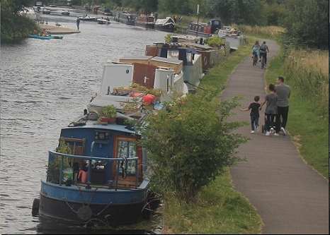
The New River which passes through the centre of the town, and supplies water to London was constructed in the early 17th century. It is is an artificial waterway opened in 1613 to supply London with fresh drinking water taken from Chadwell and Amwell Springs near Ware in Hertfordshire, and later the River Lea and other sources. Originally conceived by Edmund Colthurst and completed by Hugh Myddelton, it was operated by the New River Company for nearly 300 years until London's water supply was taken over by the Metropolitan Water Board in 1904.The area was exploited for its gravel and sand extraction in the twentieth century leaving numerous water-filled lakes. Several of the lakes form part of the Lee Valley Regional Park.
Click here to go to back to the Broxbourne u3a pages
Acknowledgment to Wikipedia for above information.